 New York Metropolitan Transportation Council
The New York Metropolitan Transportation Council utilizes GIS to link information (data) to locations. By linking data with their locations, relationships, patterns and trends can be better analyzed and interpreted. GIS is a powerful tool used to enhance the planning process in the NYMTC area. GIS is used in many different industries such as transportation, environmental, planning, and homeland security, to name a few.
Transportation Information Gateway (TIG)
Map Inventory
Transportation Information Gateway →
Communities of Concern:
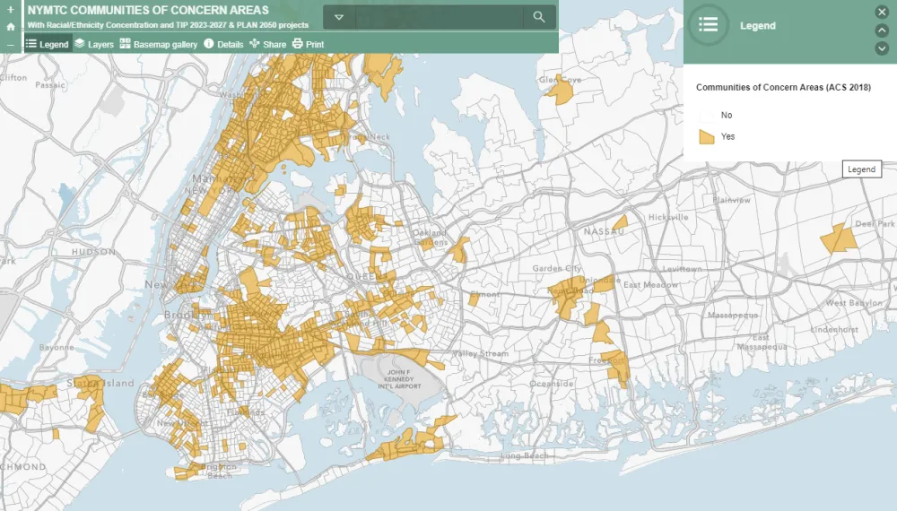
This map demonstrates the communities of concern zones/areas in NYMTC region along with the current TIP 2023-2027 and PLAN 2050 projects.
The communities of concern areas are defined by two variables, population below poverty and minority population. The thresholds for each of the variables has been calculated by taking the average of the variable across all the ten NYMTC counties.
For the year 2018, a census tract with percentage of minority population 57% or more and percentage of population below poverty level 14% or more is termed as an area of concern.
A layer called Congested Roadways shows Roadways where volume-to-capacity (VC) ratio is greater than 0.8 along the extent of a corridor. There are other Race and Ethnicity layers on this map derived from ACS 2019 5 - year Estimates.
NYMTC COMMUNITIES OF CONCERN AREAS (arcgis.com) →
GIS Resources
NYMTC has created a GIS Resources page that contains links to general GIS information from a variety of sources. Click below for further data.
click to access GIS Resources →